

Climb Baden Street toward Martha and the sidewalk ends before anything that resembles a park begins. The grade steepens, the houses fall away on one side, eucalyptus closes overhead. Then the canopy opens at the hilltop and there is San Bruno Mountain to the southeast, the ridgeline of McLaren Park, sky suddenly wide after the tight residential blocks below. Underfoot, the soil has worn through in places to expose the reddish Franciscan chert that is the hill's actual substance. San Francisco Recreation and Park describes the site as a "secluded hilltop Natural Area" popular with dog-walkers and birdwatchers. The city's 2006 management plan calls much of the terrain "too steep for casual access." No restroom. No paved path. Invasive grasses dominate the slopes. Red-tailed hawks nest in the canopy.
By most measures, it is the least polished park in Sunnyside. And it bears the name of the person who spent forty years arguing that cities needed exactly this kind of space.
The Almanac's first issue told the preservation story of this hilltop in "The Rock That Stayed": the chert knoll threatened by road cuts and development, the coalition of Sunnyside, Glen Park, and Miraloma residents who fought to keep it open, the Open Space Fund acquisition in the late 1970s, the February 1979 dedication. That piece covered the place. This one covers the person whose name is on it, and why that name fits so precisely.
1938: Housing, Then Structure
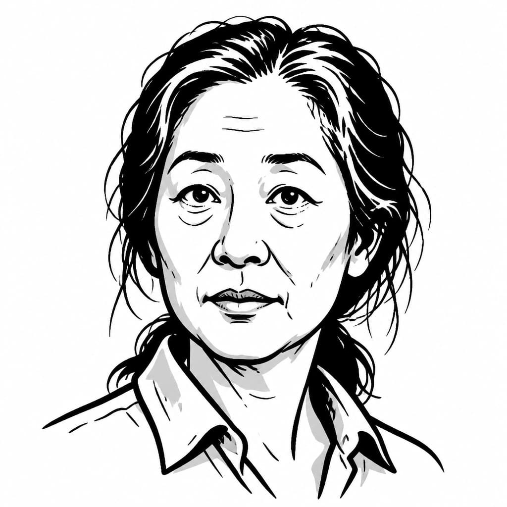
Dorothy Ward Erskine was born in San Francisco in 1896 and died there in 1982. She is remembered as a conservationist, the founder of the organization that became Greenbelt Alliance, and a figure whose advocacy helped protect tens of thousands of acres of Bay Area open space. All of that is accurate. But Erskine herself, in a 1971 interview published by SPUR, was careful to correct the assumption that her work began with land.
"It never began with open space." It began with slums.
In 1938, as she recounted in that interview, Erskine helped organize a privately financed housing survey of San Francisco's Chinatown, documenting conditions that became part of the case for public housing in the city. From housing she moved to city planning; from city planning to regional planning; from regional planning to open space. The progression was continuous, each stage an extension of the same question she had been asking since the 1930s: how should a city organize itself so that people can live well in it?
The sequence matters because it produced a particular kind of conservationist. Erskine's path to open-space preservation ran through the conviction that cities needed structure, and that open land within and around cities was part of that structure. SPUR's editors, introducing the interview decades later, argued that Erskine anticipated what they called "smart growth environmentalism": the understanding that saving open space required directing growth into existing urban areas rather than letting it sprawl outward. Erskine reached that conclusion in the 1950s, before the term existed.
What she wanted preserved was not scenic. In an oral interview quoted by Greenbelt Alliance's account of her legacy, she recalled watching San Francisco fill in after World War I. The memory carried feeling without sentimentality: "You wanted the open spaces. You wanted something left." The "something" she meant was not curated landscape. It was the rough, unimproved ground that cities tend to classify as vacant rather than valuable. Hills too steep to build on. Lots too rocky to grade. The leftover terrain that developers skip and planners ignore until someone proposes a road cut or a subdivision and the neighborhood discovers that the empty hilltop they walked past every day was holding something together.
1958–1974: Nine Counties to Proposition J
In 1958, Erskine and planner Jack Kent founded Citizens for Regional Recreation and Parks. The organization's name changes trace a widening aperture: it became People for Open Space in 1969, then Greenbelt Alliance. The original mission focused on parks and recreational areas in the nine Bay Area counties. By 1969, the scope had expanded to include farms, ranches, and wildlife habitat.
The founding logic, as Erskine described it in the SPUR interview, was organizational before it was ecological. Conservationists across the nine counties were fighting local battles and beginning to think in regional terms. Citizens for Regional Recreation and Parks gave them a structure for doing so. The strategy was to pursue large regional parks in counties where suburban sprawl was already consuming open land, getting people accustomed to thinking about land use at a scale larger than their own city. Erskine was not a theorist issuing position papers from a distance. She was an organizer who understood that the right institutional structure could channel scattered local energy into regional force.
Within San Francisco, that regional thinking produced a specific funding mechanism. On November 5, 1974, city voters approved Proposition J by a margin of roughly 116,654 to 64,527. The measure established what the Board of Supervisors Budget Analyst later described as the Open Space Acquisition and Park Renovation Program, setting aside a portion of property tax revenue for fifteen years to buy remaining open land in the city. Greenbelt Alliance's published institutional history credits Erskine's advocacy with the measure's passage.
Proposition J did not name specific parcels. It created a fund and a mandate. What happened next depended on which neighborhoods organized to use it.
1977–1979: What the Record Shows
The documentary trail requires honesty about its gaps.
No accessible source places Dorothy Erskine at a meeting about the rocky hilltop at Baden and Martha. She did not, so far as the public record reveals, petition for this specific parcel, attend neighborhood sessions about it, or advocate for its acquisition. The Budget Analyst's acquisition table lists Dorothy Erskine Park as a 1978 purchase of 0.79 acres for $15,000. (Rec and Park gives the acquisition year as 1977; the discrepancy, like many in municipal records, likely reflects the difference between agreement and closing.) The same Proposition J fund, in the same period, purchased the Sunnyside Conservatory.
The connection between Erskine and the hilltop runs through institutions rather than through personal advocacy for this site. Erskine helped build the mechanism. Sunnyside residents used the mechanism to save the hill. Then they named it for the woman whose career had argued that exactly such hills deserved saving.
The Sunnyside History Project, citing the San Francisco Chronicle of February 25, 1979, describes the park as "a joint effort of Erskine's friends and admirers, neighbors, and members of the Sunnyside, Glen Park, and Miraloma associations who fought to preserve the hill from road cuts and further development." That phrasing rewards careful reading. It distinguishes Erskine's friends and admirers from the neighborhood associations. The naming honored a legacy. It did not credit a local campaign.
The History Project's published dedication photograph shows Erskine, then eighty-two, alongside Mayor Dianne Feinstein, Parks and Recreation's Tom Malloy, neighborhood advocate Mary Burns, and Ken Hoegger, the Sunnyside resident who had led the campaign to landmark the Conservatory in 1975. Hoegger's presence at both the Conservatory campaign and the Erskine Park dedication illuminates a pattern familiar in neighborhood civic life: the same actors, using the same Proposition J funding, working across multiple preservation efforts in the same years. Jacqueline Proctor's Mt. Davidson history identifies the dedication as established by the Sunnyside Neighborhood Association.
The Fit
The indirect connection could be read as merely ceremonial. Erskine didn't fight for this specific hill; the naming is honorific, polite, detached from the ground it marks.
But that reading underestimates how precisely the site matches the argument.
Dorothy Erskine spent four decades insisting that cities needed to keep their rough ground. The ordinary open spaces that no one thought to protect until they were gone. Scenic overlooks and manicured gardens mattered too, but her career was built on the less obvious claim: that the leftover terrain, the steep lots and rocky hilltops, served a structural function in urban life. She arrived at that position through urban planning, through the conviction that a city's structure included its absences, the places where nothing was built. The hilltop at Baden and Martha is not a park in any conventional sense. It is 0.79 acres of ground that the city decided to keep open, funded by a mechanism Erskine helped create, acquired because neighbors organized across three associations to use that mechanism, and named for the woman whose career had articulated why such ground mattered.
The naming illustrated her argument as much as it honored her.
Baden and Martha, July 2026
Erskine died in 1982, three years after the dedication. The park she never campaigned for but perfectly represents has continued in the condition she would have recognized: rough, steep, uncurated.
Friends of Dorothy Erskine Park, a volunteer stewardship group, works to manage invasive species on the slopes. The 2006 management plan found that every mapped vegetation type on the site was dominated by invasives and recommended reducing them while preserving grassland and scrub habitat. Storms in December 2022 brought down eucalyptus trees along the park's edges, a reminder that keeping ground open is not a one-time decision but an ongoing negotiation with the land itself. Erskine would have understood that negotiation. Her career was built on the premise that open space in a city is not a luxury but infrastructure, and infrastructure requires maintenance.
The hilltop at Baden and Martha is public land because voters approved a funding mechanism in 1974, because neighbors organized across three associations to use it, and because the city chose to name the result for a woman who had spent her life arguing that ground like this was worth the trouble of keeping.
Walk up Baden to Martha. The chert is still there, just under the surface. The soil is thin. The hawks nest. The park looks like nothing was done to it, which is, if you know the documentary record, evidence that something was.
-
Proposition J's other purchase: The same 1974 Open Space Fund that acquired the Baden Street hilltop also purchased the Sunnyside Conservatory at 236 Monterey Boulevard, where a demolition permit was issued and partially executed before neighbors intervened.
-
Erskine's papers survive: The Online Archive of California lists the Dorothy Ward Erskine papers, circa 1950–1982, held in San Francisco, which may contain correspondence or records that clarify her connection to specific city acquisitions.
-
Ken Hoegger across campaigns: The Western Neighborhoods Project documents Hoegger leading the neighborhood association that fought to landmark the Conservatory in 1975, and he appears again at the 1979 Erskine Park dedication, a pattern of the same civic actors working multiple preservation efforts in the same years.
-
Stewardship continues on the slopes: A March 2026 Glen Park Association article profiles volunteers caring for natural areas including Dorothy Erskine Park, where invasive species management and habitat restoration remain ongoing work.