

It was snowing at Bishop's Lodge outside Santa Fe on the morning of November 24, 1922, when Herbert Hoover called the twenty-fourth meeting of the Colorado River Commission to order at 9:45 AM. Seven state commissioners sat with him under wooden rafters in a small resort reachable only by a road so rough it had discouraged most of the press. Hoover had chosen the place for exactly that reason. He wanted the commissioners sequestered, the delegations trimmed, the camp followers gone. Hearing that the lodge had booked as many as four to a room, he ordered his secretary to reduce the guest list, limiting occupancy to two per room. California's commissioner, W.F. McClure, resisted excluding his state's advisors. Most of them made the daily trek over the rough road anyway.
They had been at it for sixteen days in Santa Fe, and before that, eleven months of meetings cycling through Washington and Phoenix, collapsing and reconvening, arguing over a question that sounds simple and was not: how do you divide a river among seven states when you aren't sure how much water is in it?
That morning they signed a document that answered the question. The Colorado River Compact allocated 7.5 million acre-feet of water per year to the upper basin states and 7.5 million to the lower basin, grounded in an estimate that the river carried an average of 16.4 million acre-feet annually past Lee Ferry, Arizona, the dividing point between the two basins. The commissioners had reason to believe that estimate was too high. They used it anyway. The West as we know it was built on what followed.
The Room and the Fear
The seven commissioners included four state engineers, a state water commissioner, a water lawyer, and a state supreme court justice. The group was technically sophisticated but also politically seasoned. Stephen B. Davis Jr. of New Mexico, the supreme court justice, had been studying the Colorado River Basin since 1895 and impressed the other commissioners with his knowledge from the first meeting. The intellectual architect of the whole enterprise was Colorado's Delph E. Carpenter, a water lawyer who had conceived the idea of using the interstate compact mechanism, modeled on international treaties, as a constitutional tool under Article I, Section 10 of the Constitution. Carpenter believed that solving water conflicts between states required "statesmanship of the highest order." He had studied international treaties to design the framework. He was not a man who stumbled into this room.
Hoover, then Secretary of Commerce, had been appointed by President Harding as the federal representative and unanimously elected chairman. His stated goal was to "prevent endless litigation which will inevitably arise in the conflict of states rights." His operational goal was to make a deal, and only 53 days remained under the authorizing law's one-year deadline.
The urgency was California. By April 1922, it had become clear that the greatest threat to the upper basin states was that rapidly growing California would consume the river before anyone else could develop their share. Under the Supreme Court's recent ruling in Wyoming v. Colorado, which applied prior appropriation doctrine across state lines, the state that put water to use first owned it. California was putting water to use first. Colorado, Wyoming, Utah, and New Mexico watched this with the particular anxiety of people who can see their inheritance being spent by a faster-moving relative.
California, meanwhile, needed the compact for its own reasons. Without a seven-state agreement, Congress would never authorize the massive dam California wanted on the lower river. As Floyd Dominy, a Bureau of Reclamation commissioner speaking decades later with the benefit of hindsight and his own institutional loyalties, put it: "The reason the compact came out the way it did was because California wanted Hoover Dam. And they wanted the All-American Canal."
So the upper basin needed protection from California, and California needed the compact to unlock federal money. Everyone needed a deal. The question was what number to put on it.
What They Knew
Prior to 1899, there were no stream discharge measurements in the Colorado River Basin. The river's central canyon region, roughly 520 miles of it, was accessible to wheeled vehicles at only three points. The gauge station at Lee Ferry, the point that would become the legal hinge of the entire compact, was established in the summer of 1921. The commissioners were dividing a river with barely one year of direct measurement at the spot that mattered most.
The number they used, 16.4 million acre-feet, came from a Reclamation Service report produced under the authority of Interior Secretary Albert Fall and Reclamation Service director Arthur Powell Davis. The methodology was indirect: measurements taken at Laguna Dam near Yuma, Arizona, roughly 620 miles downstream of Lee Ferry, with the Gila River's contribution subtracted and an assumption that tributary gains between the two points roughly equaled evaporation losses. It was the kind of calculation you make when you need an answer more than you need accuracy.
But a better answer existed. E.C. LaRue, a hydrologist for the U.S. Geological Survey, had spent years hiking the river and its tributaries, collecting firsthand measurements of depth and flow. He had creatively used water level records from Great Salt Lake, calibrated against later discharge records, to infer annual flows back to 1895. His resulting estimate was approximately 1.4 million acre-feet per year lower than the Reclamation Service figure. Decades later, his inferred discharges for those early years proved consistent with values estimated from tree ring studies.
LaRue did not keep quiet. In his 1916 USGS report, six years before the compact was signed, he had written plainly:
"The flow of the Colorado River and its tributaries is not sufficient to irrigate all the irrigable lands lying within the basin. More complete data would probably indicate a greater shortage in the water supply available."
As the compact negotiations gathered momentum, LaRue tried repeatedly to get the commission's attention. He attempted to arrange a meeting between the USGS and the Reclamation Service to address the discrepancy between his estimate and theirs. He failed. He then took the unusual step of writing directly to Secretary Hoover. He received a thank-you note in return.
LaRue had company. Turn-of-the-century hydrologists had a reasonably good idea of how much water the river could spare. A USGS hydrologist named Herman Stabler reached similar conclusions, as did an engineering professor at the University of Arizona and a high-level commission appointed by Congress and headed by a famous Army Corps lieutenant general. The commission, as Kuhn and Fleck wrote in Science Be Dammed, "refused to be distracted by any lower estimate of river discharge and forged ahead."
"They had a glaring need for sound information but no concerted attempt was made to call on the scientific community for help…. Without authoritative data, they had an opportunity to pick and choose information that best suited their interests and uncertainties. And that is what they did." — Norris Hundley
What They Chose
Hoover's solution to the deadlock was architectural. Rather than dividing water among seven states, each with competing claims and projections, he proposed dividing the river into two basins and allocating a fixed amount to each. The upper basin commissioners had proposed 6.5 million acre-feet per year. Half the assumed total flow would have been 8.2 million. Hoover split the difference: 7.5 million acre-feet to each basin.
The number was a political compromise between two endpoints, one of which was derived from data the commission had been warned was too generous. And it was expressed in fixed amounts of water, measured in absolute acre-feet, not as percentages of the river's actual flow. If the river turned out to carry less water than assumed, the allocations would not adjust downward. They would simply exceed what existed.
A percentage-based allocation would have automatically corrected for overestimation. A fixed allocation converted an optimistic guess into a permanent entitlement. Every dam, canal, city, and farm built afterward was built on the assumption that the entitlement was real.
Hoover himself may have understood the arrangement as temporary. Later testimony suggests he gave the agreement a shelf life of about 75 years. He was off by roughly 30 years in the optimistic direction.
One absence requires mention. No tribal nations were represented at Bishop's Lodge, despite holding water rights that predated every state claim at the table. The compact's Article VII disclaimed "any intention of affecting the performance of any obligations owing by the United States to Indians." Hundley found that no attempt was made to discover how many Indians were in the basin or what their water needs were. The commission assumed those rights were "negligible." They were not. That story requires its own telling. (See sidebar.)
The Number Becomes Concrete
Arizona's commissioner, W.S. Norviel, signed the compact knowing his incoming governor opposed it and that his own job as state water commissioner would end when the new administration took office. It is, as the Utton Center's reconstruction notes, a credit to Norviel that he didn't simply tell the other commissioners Arizona wasn't interested, pack his bags, and go home. He signed anyway. Arizona would not ratify for another 22 years.
But the compact did not need Arizona to begin reshaping the physical world.
In December 1928, Congress passed the Boulder Canyon Project Act, largely written by Hoover himself, authorizing construction of what would become Hoover Dam. When completed in 1936, it was the highest dam ever built, impounding Lake Mead behind it. The cost was $49 million, roughly $900 million in current terms. The estimated flow of 16.4 million acre-feet was no longer a number on paper. It was a wall of concrete 726 feet tall, and behind it a reservoir that assumed the river would keep filling it.
That assumption was the ratchet. Each physical structure built on the compact's number made the number harder to revisit, because revisiting the number meant acknowledging that the structure it justified might not have enough water to serve its purpose. And so the number justified more structures, and the structures justified the number.
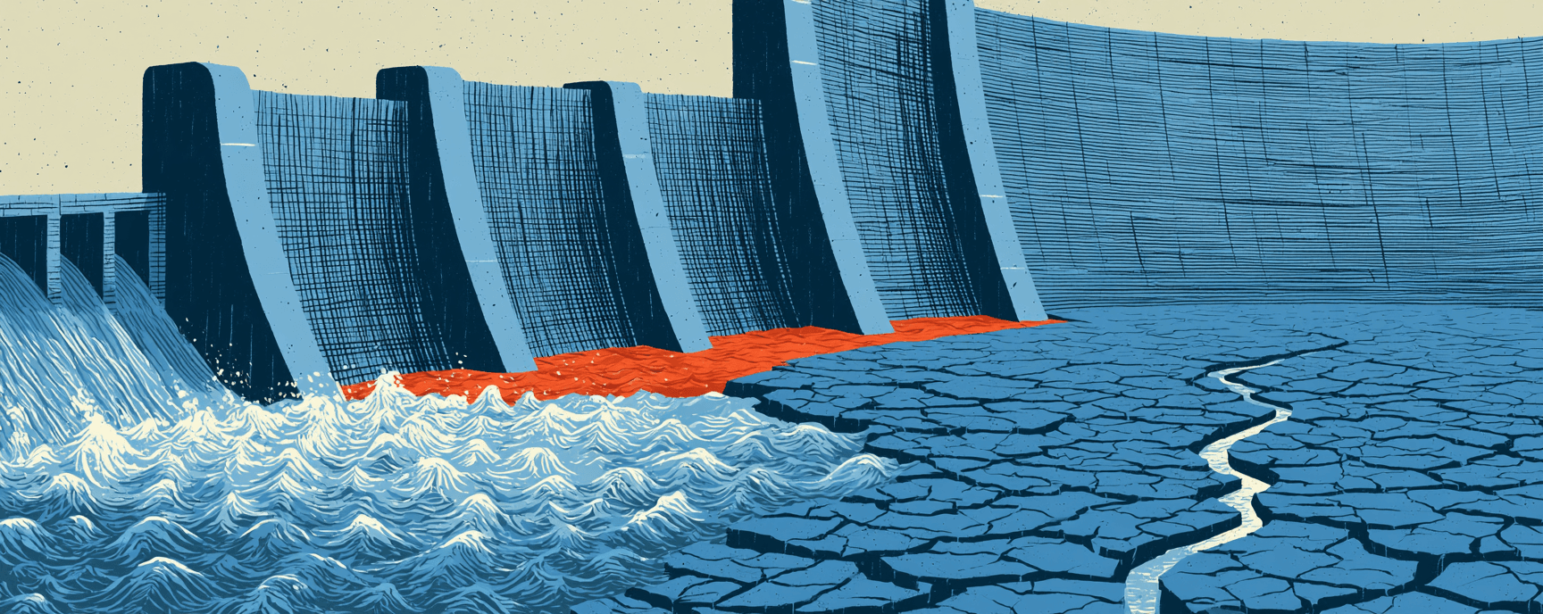
Glen Canyon Dam, authorized in 1956 and closed in 1963, created Lake Powell with a capacity of 27 million acre-feet. The river now had two massive reservoirs whose combined storage dwarfed any single year's flow. Between them, they could absorb years of variation, banking wet years against dry ones. As long as the reservoirs were filling, the arithmetic didn't bite. Storage masked the mismatch. The bathtub was big enough that nobody had to look at the faucet.
Meanwhile, the paper commitments kept stacking. The Mexican Water Treaty of 1944 added 1.5 million acre-feet of annual obligation. The Central Arizona Project, authorized in 1968 and completed in the 1990s, diverted up to 1.5 million acre-feet to central and southern Arizona. Total paper obligations on the river now exceeded 17.5 million acre-feet per year. For the first time, all states were drawing near their legal maximums. The cushion was gone. But the reservoirs still had water in them, and water in a reservoir looks like abundance even when the inflow says otherwise.
What the River Actually Carried
The commissioners at Bishop's Lodge were dividing a river for a basin whose population in 1915 was approximately 457,000. Hoover predicted it would quadruple. More than 40 million people depend on the Colorado River today.
Lee Ferry's gauge, the one established barely a year before the compact was signed, has now accumulated over a century of measurements. The gap between what was promised and what exists has only widened:
| Estimate | Annual Flow (million acre-feet) | Source |
|---|---|---|
| 1922 Reclamation Service figure (used in compact) | 16.4 | Laguna Dam measurements, indirect calculation |
| LaRue's USGS estimate (ignored) | ~15.0 | Field measurements, Salt Lake calibration |
| Actual gauge average through 2016 | 14.8 | Lee Ferry gauge record |
| Tree ring reconstructions (long-term) | 13.2–14.3 | Paleoclimate studies |
| Total paper allocations (all obligations) | 17.5+ | Compact + Mexico treaty + state projects |
The number the commissioners chose described a river that does not exist and, as far as the paleoclimate record can determine, never has.
The steady depletion of reservoir storage due to overallocation is now called the "structural deficit." The lower basin states have been using roughly 1.2 million acre-feet annually more than the river delivers on average. The deficit persists even in non-drought years. It is structural in the precise sense that it was built into the framework at Bishop's Lodge, when the commissioners chose 16.4 million over LaRue's lower figure, chose fixed allocations over percentages, and chose to answer his warning with a thank-you note.
The 2000–2022 megadrought drove reservoir levels to their lowest points since construction and triggered the first federally declared water shortage for the Colorado River Basin. The deficit had been there since 1922, in the gap between what the commissioners suspected and what they signed. It compounded in 1936, when Hoover Dam turned an optimistic estimate into a reservoir. It compounded again in 1963, when Glen Canyon Dam created a second reservoir to store water the river didn't have. Each structure made the eventual reckoning larger without making it less inevitable.
The Logic of the Generous Number
The conventional defense of the compact's framers, popularized by Marc Reisner's 1986 Cadillac Desert, held that they simply couldn't have known they were allocating water during an unusually wet period. Kuhn and Fleck's archival research dismantled that defense. The commissioners had access to lower estimates. They had been directly warned. They chose the higher number.
Whether they had a real choice is worth considering. Without an agreement, California would have consumed the river under prior appropriation doctrine. The upper basin states would have spent decades in litigation while California built. The dam that everyone wanted would never have been authorized. The only number that could produce agreement among seven states with fundamentally competing interests was a number generous enough that everyone could believe there was enough for them. A lower number would have forced someone to accept less. No one was willing to accept less. And so the number had to be large enough to accommodate seven sets of ambitions, plus Mexico, plus the future.
LaRue's estimate, had it been adopted, would have forced the commissioners to confront a zero-sum problem. The Reclamation Service estimate let them treat it as positive-sum. The pretense was what made the deal possible. And the deal was what made the dam possible. And everything that forty million people now depend on followed from the dam.
Anyone who has ever sat in a room where a deal needs to get done knows what this looks like. You sign because the alternative to signing is worse than the consequences of the number being wrong, and because the consequences of the number being wrong will fall on someone who isn't in the room yet. The commissioners at Bishop's Lodge were practical men who needed a framework more than they needed the truth, and the framework required a generous number, and the generous number required ignoring the man who had the better data. That sequence has a logic to it. The logic is what makes it so durable.
The compact is now 104 years old, roughly 30 years past the shelf life Hoover reportedly envisioned. The wooden rafters at Bishop's Lodge are still there, enclosed within a larger building that now serves as the resort's restaurant. No commemorative marker notes what happened beneath them.
- The October 1 deadline: The Bureau of Reclamation's post-2026 operating guidelines for the Colorado River are due by October 1, 2026, the same week the National Flood Insurance Program expires on September 30 after 35 consecutive short-term reauthorizations.
- Tribal water claims unresolved: The compact's Article VII disclaimed any effect on tribal obligations, but 104 years later the Native American Rights Fund reports that tribal nations still hold significant unquantified water rights across the basin that post-2026 negotiations must finally address.
- The archival reconstruction: Eric Kuhn and John Fleck's 22-episode reconstruction of the compact negotiations, drawing on commission meeting minutes and contemporaneous press accounts, is freely available through the Utton Center and remains the most granular public record of what happened at Bishop's Lodge.
- The lower basin's partial offer: As of spring 2026, the lower basin states' proposal for post-2026 operations covers roughly 40 percent of the river's structural deficit through 2028, leaving the fundamental overallocation unresolved.