
In 1857, an Army officer named May Humphrey Stacy crossed the basin on horseback and described a level plain covered in luxuriant grass. In 1998, researchers finished a vegetation survey of the same ground. Mesquite dominated 59% of the Jornada Experimental Range, creosote bush another 27%. Black grama, the bunchgrass that had held the soil across most of the basin, was the primary species on 1% or less.
A grassland became a desert. The verb does too much work. It implies a single arc with a before and an after, and what happened in the Jornada Basin of southern New Mexico happened in bursts, each one making the next one easier and none of them arriving in a season anyone could point to afterward. Nothing about it resolves into a lesson you could carry somewhere else and apply.
What the record holds
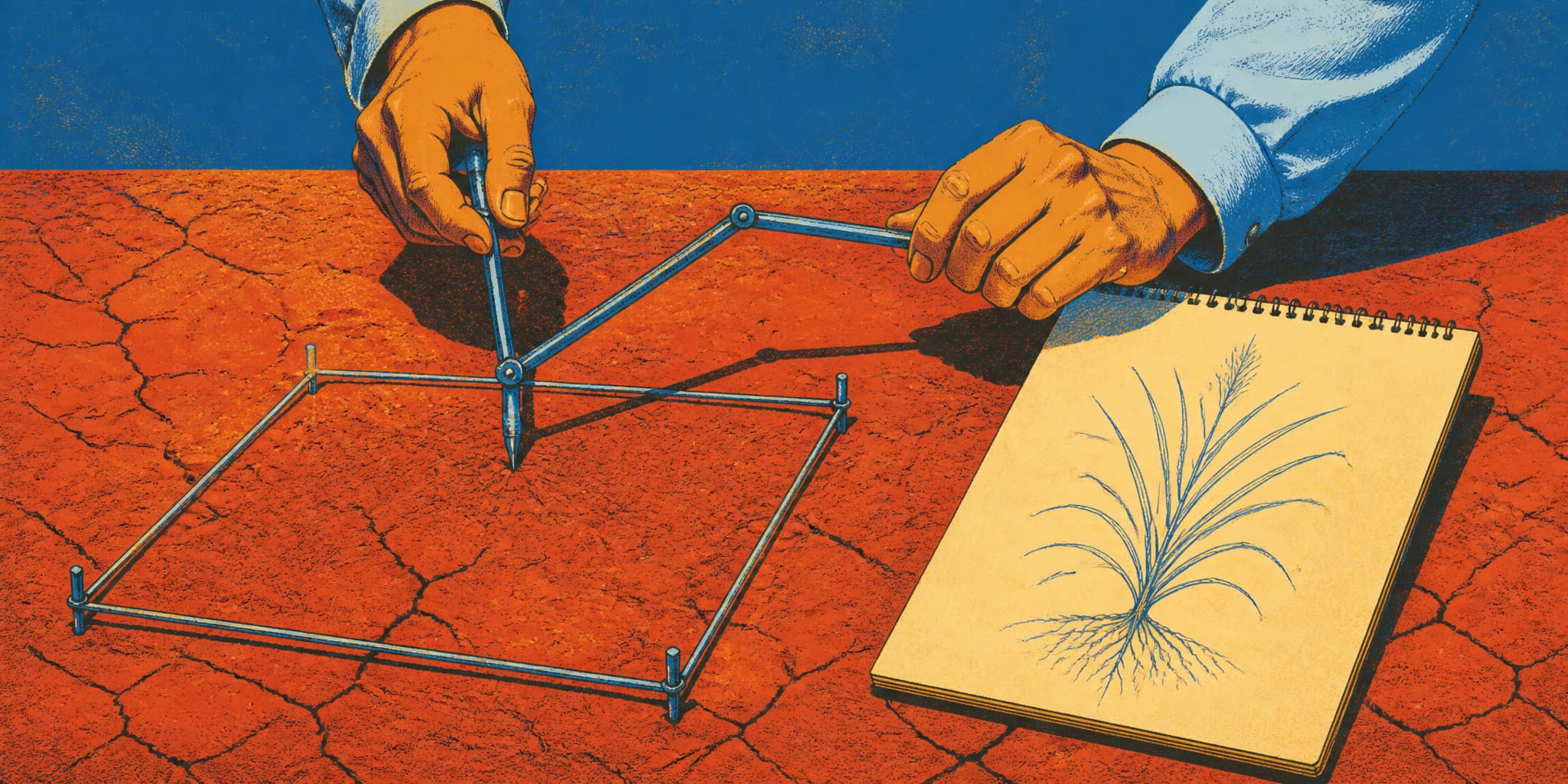
The Jornada lies between Las Cruces and the San Andres Mountains, a basin floor around four thousand feet with no drainage to the sea. It carries one of the longest rangeland research records in the country. USDA established the experimental range in 1912. New Mexico State University's College Ranch followed in 1926. The National Science Foundation's Long Term Ecological Research program arrived in 1982. The permanent vegetation plots go back to 1915: one-square-meter quadrats where somebody knelt in the dirt with a pantograph, a linked-arm drafting instrument, tracing the outline of each individual plant with one arm while a pen on the other arm drew a scaled copy onto paper. There is a gap from 1980 to 1995 when nobody did it. Calling this continuous monitoring since 1912 flatters it. What exists is a stack of separate programs, each renewed by somebody who had to argue for the money, stitched into something that now reads as one record.
The range was represented as perennial grassland in 1858, 63% shrub-dominated by 1915, 92% shrubland by 1998. The steepest drop came during the 1950s drought, when grass cover fell roughly 90% in five years and never recovered.
That is where the system started manufacturing its own permanence. Rain falling on bare desert soil detaches the fine particles at the surface. The particles wash into the pores. The pores close. Less water goes in and more runs off, which means the next storm does less good than the one before it. Meanwhile the wind lifts the loose material out of the open interspaces and drops it around the base of the mesquite, where the stems slow it down, so the shrubs end up growing on accreted mounds of soil that used to be somewhere else. The ground between the mounds gets harder every year. A grass seed landing there has nowhere to lodge.
The foundational vegetation reconstruction attributes most of the transition to historically excessive livestock grazing interacting with drought. Climate alone would probably have produced more shrubs than existed in 1858, but not dominance at this scale.
The Pacific Decadal Oscillation is a long swing in North Pacific sea-surface temperature that governs, among other things, how much winter moisture reaches the Southwest. Through most of the twentieth century, grass cover on the Jornada tracked it closely. Wet phase, more grass. Researchers reported in 2023 that the link broke after 1995: grass stayed below what the ocean cycle predicted. Warming, accumulated degradation, or both. The data can't separate them.
A 21-year fencing experiment published in 2025 kept cattle off some plots and kept cattle plus rodents and rabbits off others. Kangaroo rats and jackrabbits, native animals doing what they have always done, now hold the shrub state in place. The animals didn't change. The ground they're working did. Take the cattle off, build the fence, wait two decades, and the grass still doesn't come back.
The early pantograph drawings show grass plants traced where they stood. Drawings of the same square meter from later decades show mesquite and bare interspace. The file holds the shape of what was growing at that exact coordinate, on a date, in ink.
Two ranchers
In 2013, the Los Angeles Times reported that John Clayshulte, a third-generation rancher and farmer near Las Cruces, had pulled every cow off his federal grazing allotment, the leased public ground that most operations in the basin depend on for summer forage. "There's just not any sense putting cows on there," he said. "There's not enough for them to eat." He described the country as former shortgrass prairie that his own community had helped damage and that he did not expect to recover.
That recognition accumulates. The forage thins, you cut the herd a little, you cut it again, and the distance between what the allotment produces and what your father said it produced widens until saying it out loud is the only honest option left.
Jornada scientist Brandon Bestelmeyer told the same paper that the older assumption — remove cattle and grass returns — no longer matched places where climate and soil feedbacks had altered what recovery was possible. The fix for the original problem was no longer a fix for the current one.
Five years earlier, Tom Mobley, whose Sierra Alta Ranch north of the basin combined deeded, state, and federal land, told the New Mexico Farm & Ranch Heritage Museum that below-normal rainfall hadn't hurt him the way it hurt his neighbors. Some of them had cut their herds by half. He had never cut his 150-head permit by more than a third. He had also swapped his shallow-well windmills for solar pumps, because cattle drink most on hot still afternoons when the air sits on the basin and nothing moves, which is precisely when a windmill produces least. He identified the hour his infrastructure failed him and solved for that hour. Nowhere in his account does he mention shrub encroachment. He was working through the mechanical problems in front of him in the order they appeared.
Both men are reading the same system accurately. Clayshulte reads it and leaves. Mobley reads it and re-plumbs his water. Nothing in the basin settles which of them is right.
At the NMSU research range, a 15-year stocking experiment recorded complete destocking — every animal removed — of conservatively grazed pastures during the relatively modest 1998 drought, and of all experimental pastures from 2002 through 2005, when rainfall fell to half of normal. Grazing lightly reduced the risk of a forced sell-off in a short drought and cost money in every year that wasn't a drought. That is the whole tradeoff and it doesn't resolve. It comes back every spring, on ground producing 43% less perennial grass than it did a generation ago.
What arrives in the air
The transformation does not stay in the basin. Field measurements across five Jornada ecosystem types found the greatest wind-borne sediment flux at the most devegetated sites, and identified mesquite shrubland as likely the largest single dust source in the basin simply because there is so much of it. A separate synthesis reports horizontal sediment flux up to twenty times higher in mesquite shrubland than in black grama grassland. Grass held the soil down. Twenty times more of it moves now.
Doña Ana County, which includes Las Cruces, gets recurrent high-wind PM10 episodes — airborne particles under ten micrometers, small enough to reach the lower airway. A health study of emergency-room visits from 2007 to 2010 found respiratory visits rising with elevated particulate matter, though the authors made no claim about where the dust came from.
Shrubland produces more dust than grassland. The basin has become shrubland. The county downwind has a dust problem. But nobody has published a study tracing a measured quantity of Jornada sediment through the air to a specific monitor in Las Cruces, let alone a specific pair of lungs. The mechanism is established. The attribution at the resolution that would let anyone assign responsibility has not been attempted.
What comes back, and what doesn't
In 2017, the BLM treated roughly 7,200 acres of mesquite-invaded land near Las Cruces with aerial herbicide, which required removing livestock and deferring grazing for at least three years.
A 2026 study compared 43 matched pairs of treated and untreated plots across southern New Mexico at five, ten, and fifteen years after woody-plant removal. Killing the shrubs increased perennial grass cover and the number of plant species. But the grasses that established were mostly disturbance-adapted species rather than the ones that define the reference state, the historical grassland composition these sites are assessed against. Average grass cover never reached that benchmark. The treatments did no damage and produced real improvement on several measures. What grows back is a new community, neither the old grassland nor the shrubland it replaced.
A 1996 retrospective by Jornada scientists Kris Havstad and William Schlesinger warned against reading the historical record as a target, as though 1858 told you what correct management could restore. The soils are different now. The species pool is different. The feedbacks running today weren't running then. The past is context, they argued, and the landscape has moved off it. Whatever the altered ground can still produce is the actual question, and it deserves to be looked at as its own thing.
The person who walks the transects
Debra Peters has spent more than twenty years revisiting fifteen Jornada sites three times a year, each cycle taking weeks in the field. Same ground, same season, same measurements, entered into a dataset that already holds more change than one career can absorb. She knows what each site looked like last spring and the spring before and five springs before that. She carries the comparison in her body: where to put her feet, which transect used to take longer because there was more to write down, which plot she can now finish early because less is growing on it.
After the wet years from 2004 through 2008, grasses established in the spaces between shrubs and hung on through at least 2018. Without the earlier record, that grass would have looked like the normal condition of the place. A visitor in 2010 would have seen green between the mesquite and thought: grassland. Would have taken a photograph, shown it to somebody, said look, it's fine.
Here is Peters on what the long record provides:
"We wouldn't have known it shouldn't be this way."
I keep coming back to that sentence. The present landscape looks like a landscape. It has its own aesthetic, and the aesthetic is not impoverished. Creosote after a storm produces the smell that people who grew up in these deserts mean when they say it smells like rain. The mesquite dunelands in late light have a sculptural quality you could photograph and frame. Anyone born into this basin in 2026 would experience it as home and would be right to, and the record would still say otherwise.
The change runs too slow for the news and spreads across too many years for any single season to register as the season it happened. What registers is accumulation: the kind Clayshulte carried for a decade before he pulled his cattle, the kind Peters measures three times a year on ground she has watched long enough to know what it lost. Each year matches the year before it closely enough that the difference never clears the threshold where you'd act. To see it you need the quadrat drawings, and the rain gauge at headquarters adding another number to a series that now runs past a century, and somebody walking the lines and noting what grew and what didn't, because the land has no memory of what it used to be and is not going to volunteer the information.
The ranchers who stay will keep making their calculations. Some will adjust stocking rates and water systems, some will sell. The BLM will issue permits for country that the permits call rangeland and the vegetation maps call shrubland, and both documents will be accurate about what they describe. The dust will blow and the monitors will record it.
None of this tells anyone what to do. It tells them what happened, and keeps telling them, three times a year, as long as somebody keeps walking out there and writing down what's standing.
- The broken ocean link: A 2023 analysis found that Jornada grass cover tracked the Pacific Decadal Oscillation through most of the twentieth century but diverged after 1995, and the authors could not determine whether warming or accumulated land degradation caused the break.
- Dust events trending upward: A 2026 study of eighteen rural western monitoring sites found that dust-event frequency increased 2.2% per year from 1988 to 2022, with Southwestern variability linked more strongly to declining soil moisture than to wind speed.
- Rodents reinforcing the transition: A 21-year exclosure experiment published in December 2025 found that excluding rodents and rabbits produced two to three times as much perennial-grass cover in shrubland plots, suggesting native herbivores now help maintain the state they didn't cause.
- Restoration produces something new: A 2026 evaluation of woody-plant removal across southern New Mexico found that treated plots grew more grass but primarily disturbance-adapted species rather than the reference-grassland community, and average cover still fell short of historical levels.
